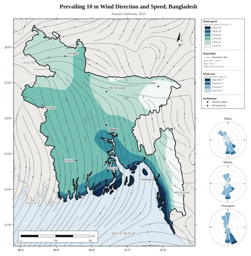
ERA5 reanalysis via Open-Meteo, with wind roses for Dhaka, Khulna and Chattogram.
Zero Hour Index, Jamuna-Padma char corridor
Where flood peaks, failed road access and submerged mobile towers leave char settlements isolated. RIMES Mapathon 2026.
Zero Hour Index, Jamuna-Padma char corridor2026
Map by Md Sabbir Islam
About this map
- Made by
- Md Sabbir Islam
- Year
- 2026
- Topic
- Hazards and climate
Using this map: please credit Md Sabbir Islam and link to this page. For a full-resolution copy or permission to reuse it, email me.
More maps
See all maps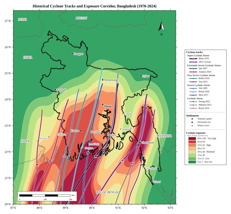
12 major storm tracks from 1970 to 2024 turned into a severity-weighted exposure corridor. Tools: Geopandas…
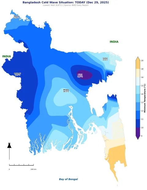
Daily minimum temperature from BMD data, made with my temperature map generator. Lowest: Nikli, 9.8 °C.
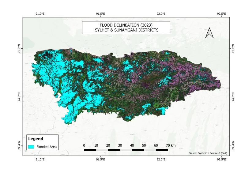
Flooded area mapped from Copernicus Sentinel-1 radar imagery.