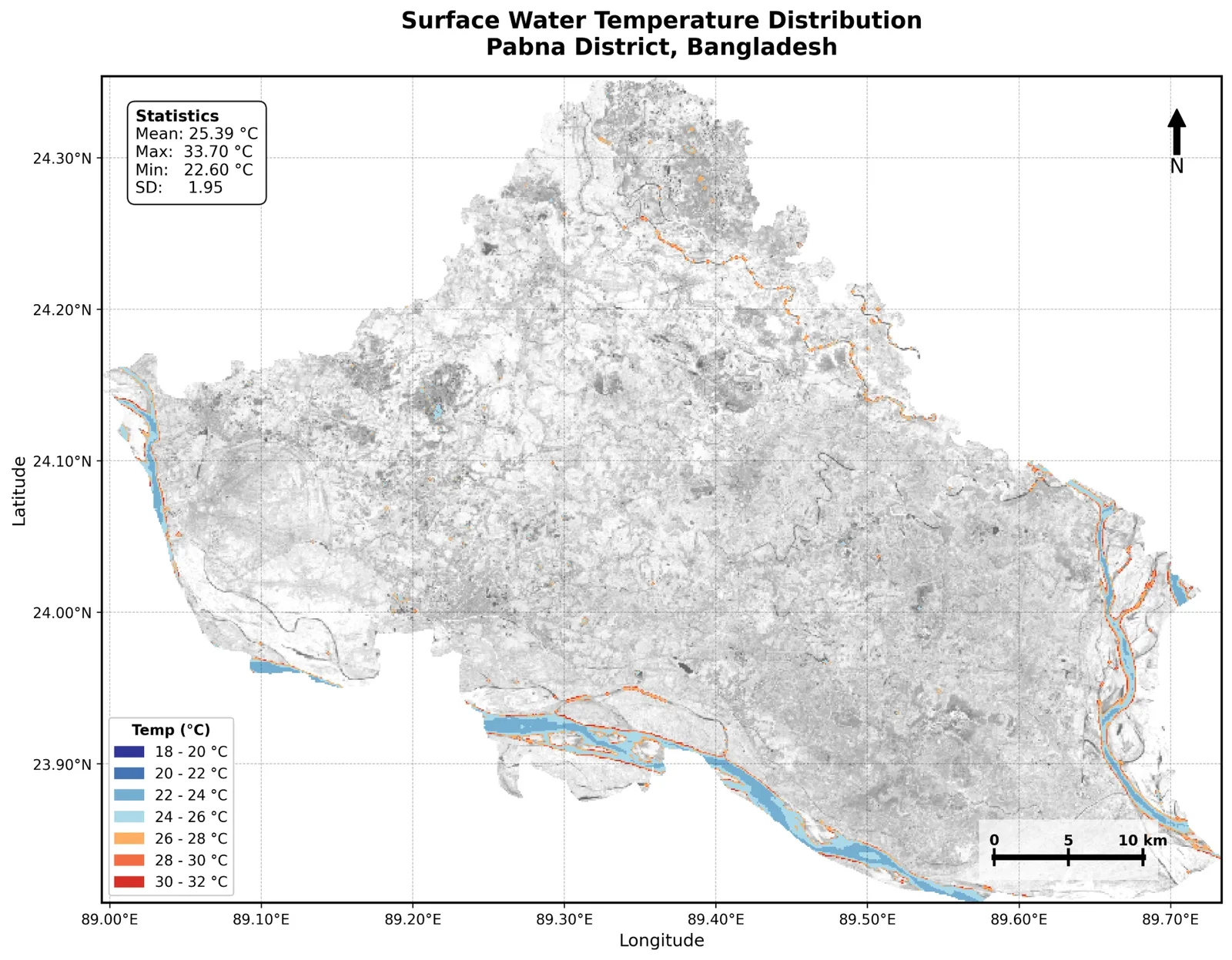
Satellite thermal analysis of rivers and water bodies. Mean 25.39 °C, range 22.6 to 33.7 °C.
Maritime Traffic Density in the Bay of Bengal (2015-2021)
Data: World Bank & IMF, Global Shipping Traffic Density (AIS). Method: Log-scaled density classification. Tools: Python (rasterio, geopandas, matplotlib).
Maritime Traffic Density in the Bay of Bengal (2015-2021)2015-2021
Map by Md Sabbir Islam
About this map
- Made by
- Md Sabbir Islam
- Year
- 2015-2021
- Topic
- Water
- Data
- World Bank & IMF, Global Shipping Traffic Density (AIS)
- Method
- Log-scaled density classification
- Tools
- Python (rasterio, geopandas, matplotlib)
Using this map: please credit Md Sabbir Islam and link to this page. For a full-resolution copy or permission to reuse it, email me.
More maps
See all maps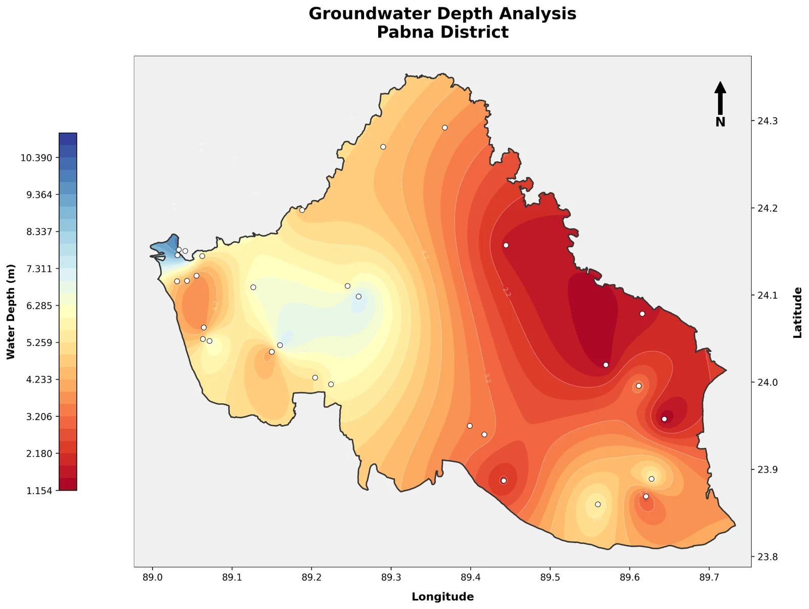
Depth to water interpolated from observation wells, 1.2 to 10.4 m.
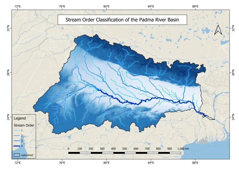
Stream orders 1 to 4 derived from a DEM, with the watershed boundary. QGIS.
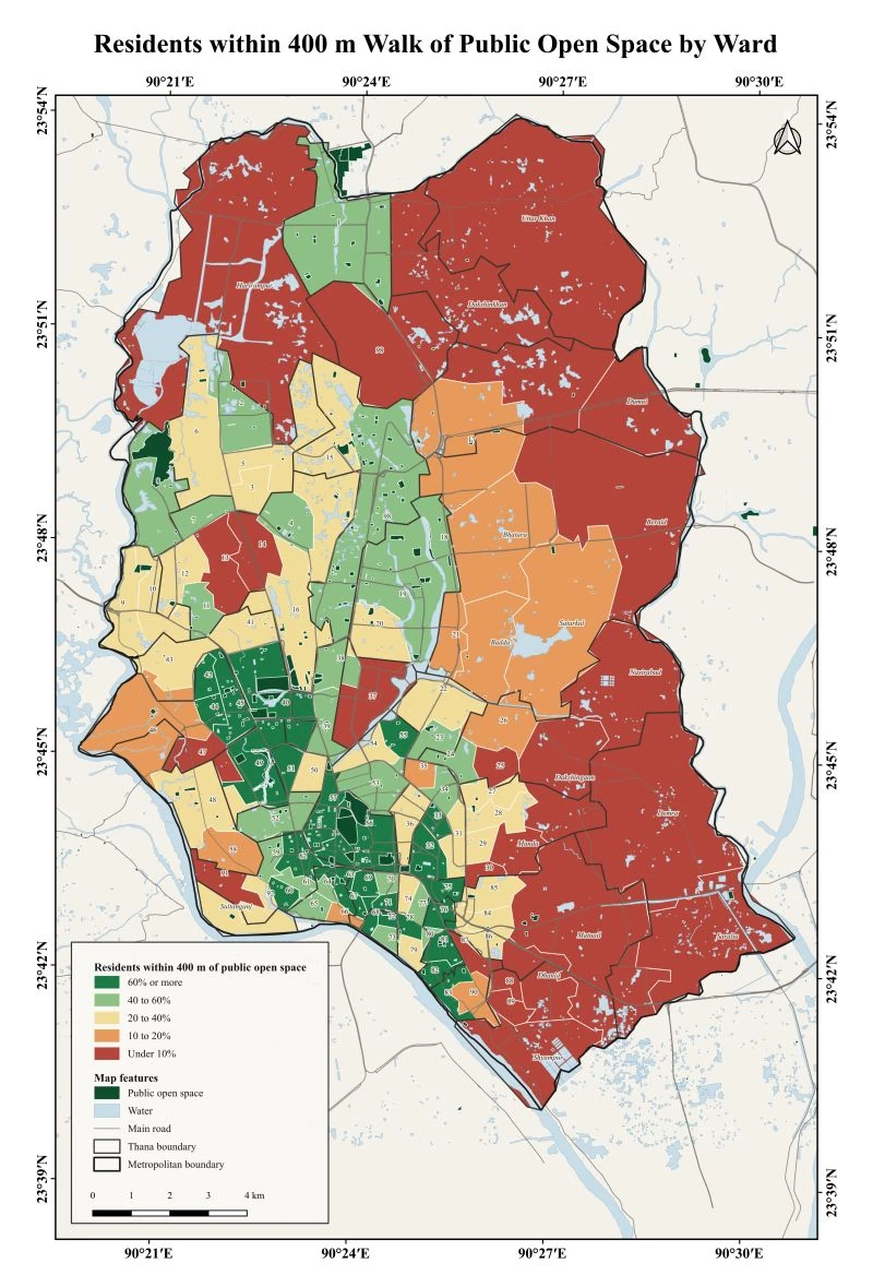
Share of residents in each Dhaka ward who live within a 400 m walk of a public open space. Data…