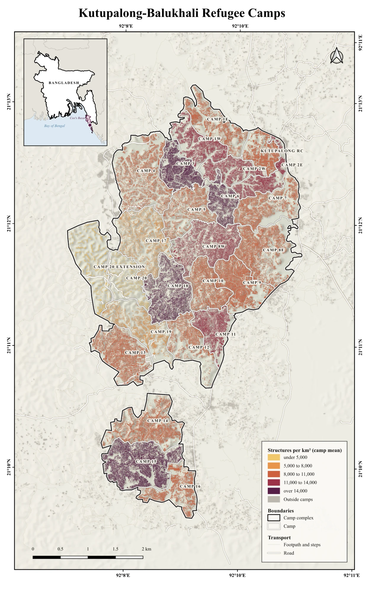
Mean density of structures per km² in each camp of the Kutupalong-Balukhali refugee camp complex, Cox's…
Walking access to public open space in Dhaka
Share of residents in each Dhaka ward who live within a 400 m walk of a public open space.
Walking access to public open space in Dhaka2026
Map by Md Sabbir Islam
About this map
- Made by
- Md Sabbir Islam
- Year
- 2026
- Topic
- Cities
- Data
- OpenStreetMap, WorldPop 2025
- Method
- Network-based walking distance
- Tools
- QGIS
Using this map: please credit Md Sabbir Islam and link to this page. For a full-resolution copy or permission to reuse it, email me.
More maps
See all maps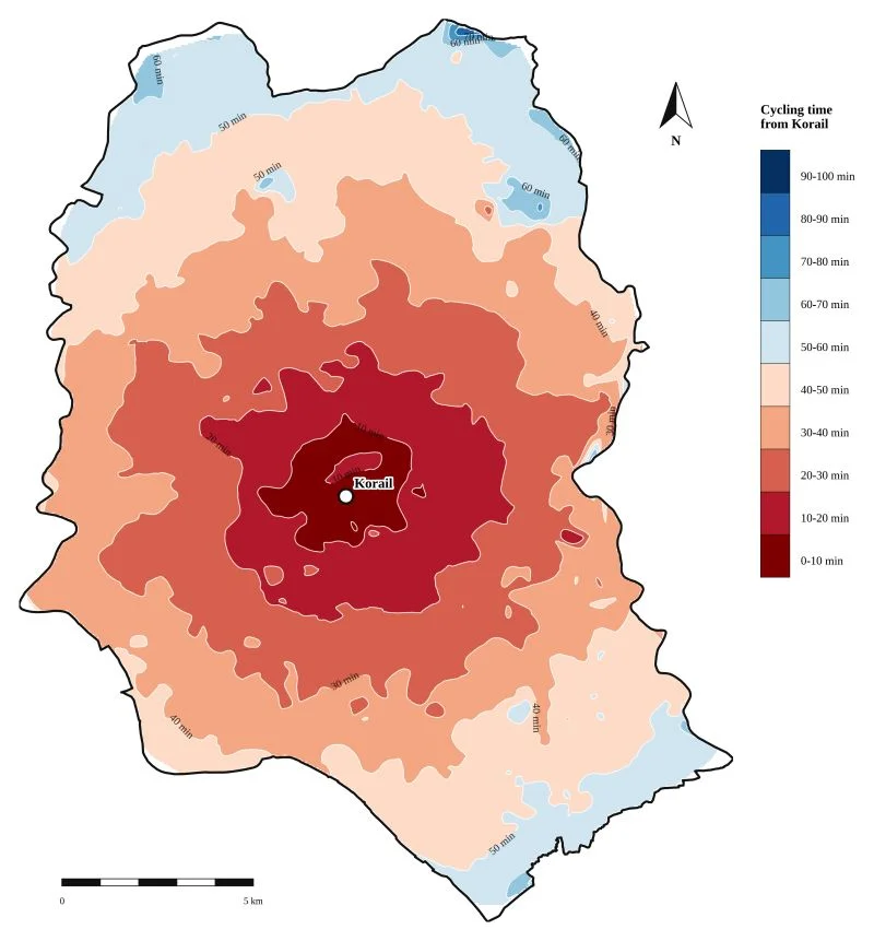
2,000 sampled points routed with OpenRouteService, cubic spline interpolation.
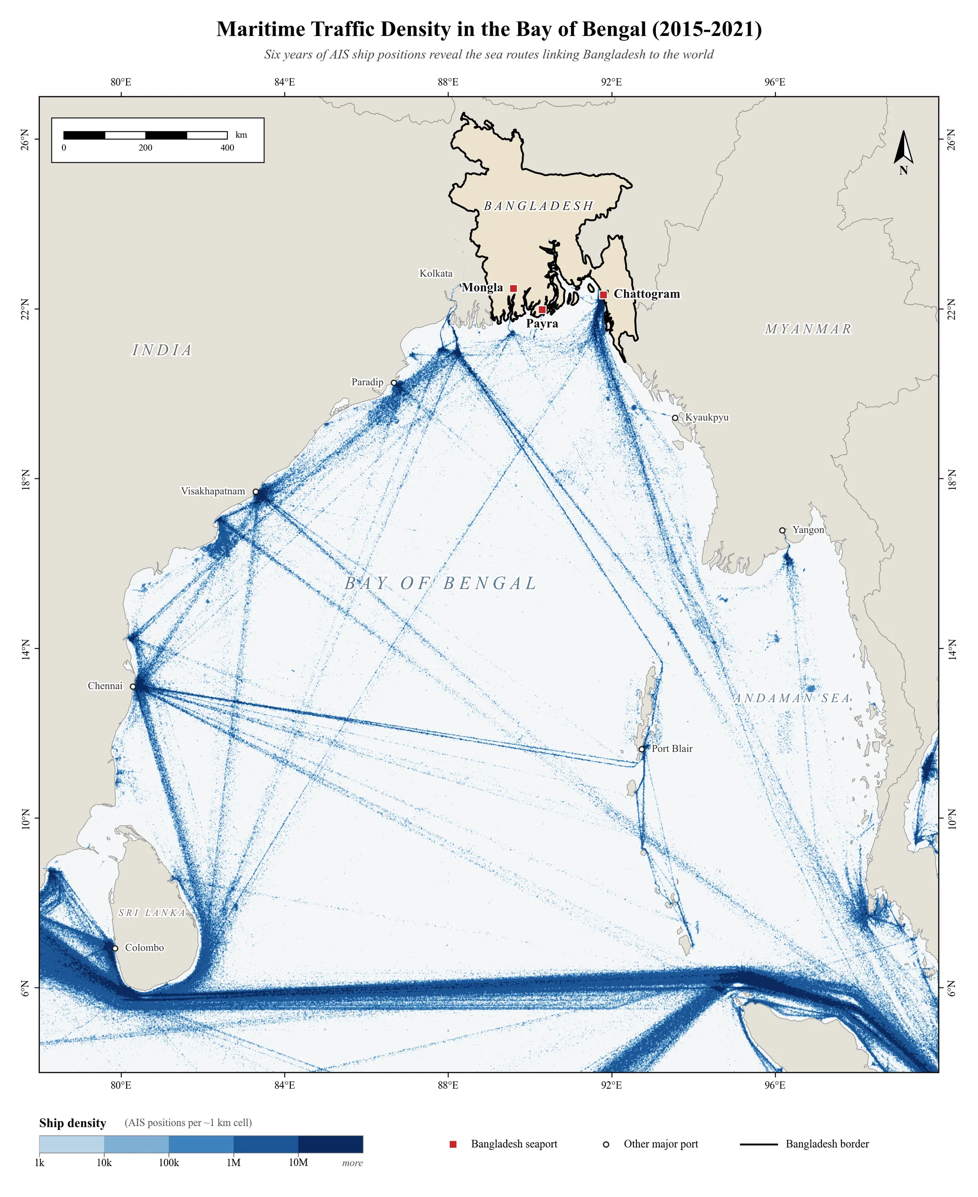
Data: World Bank & IMF, Global Shipping Traffic Density (AIS). Method: Log-scaled density classification.…
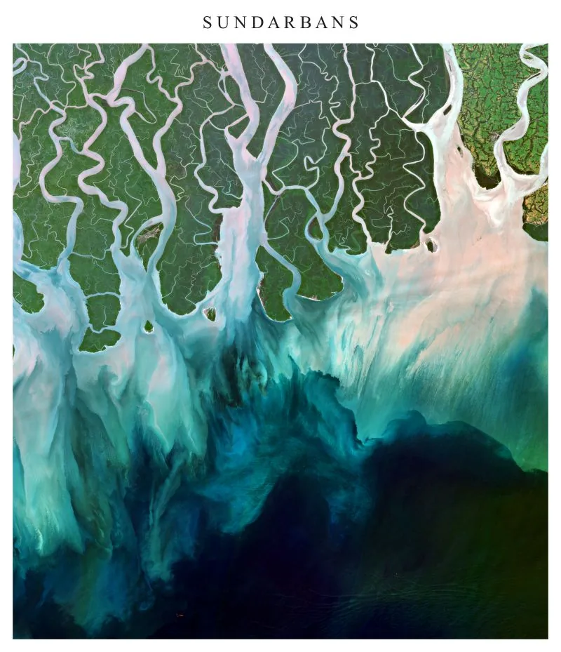
True-colour satellite view of the Sundarbans mangrove forest, where tidal channels carry sediment into the…