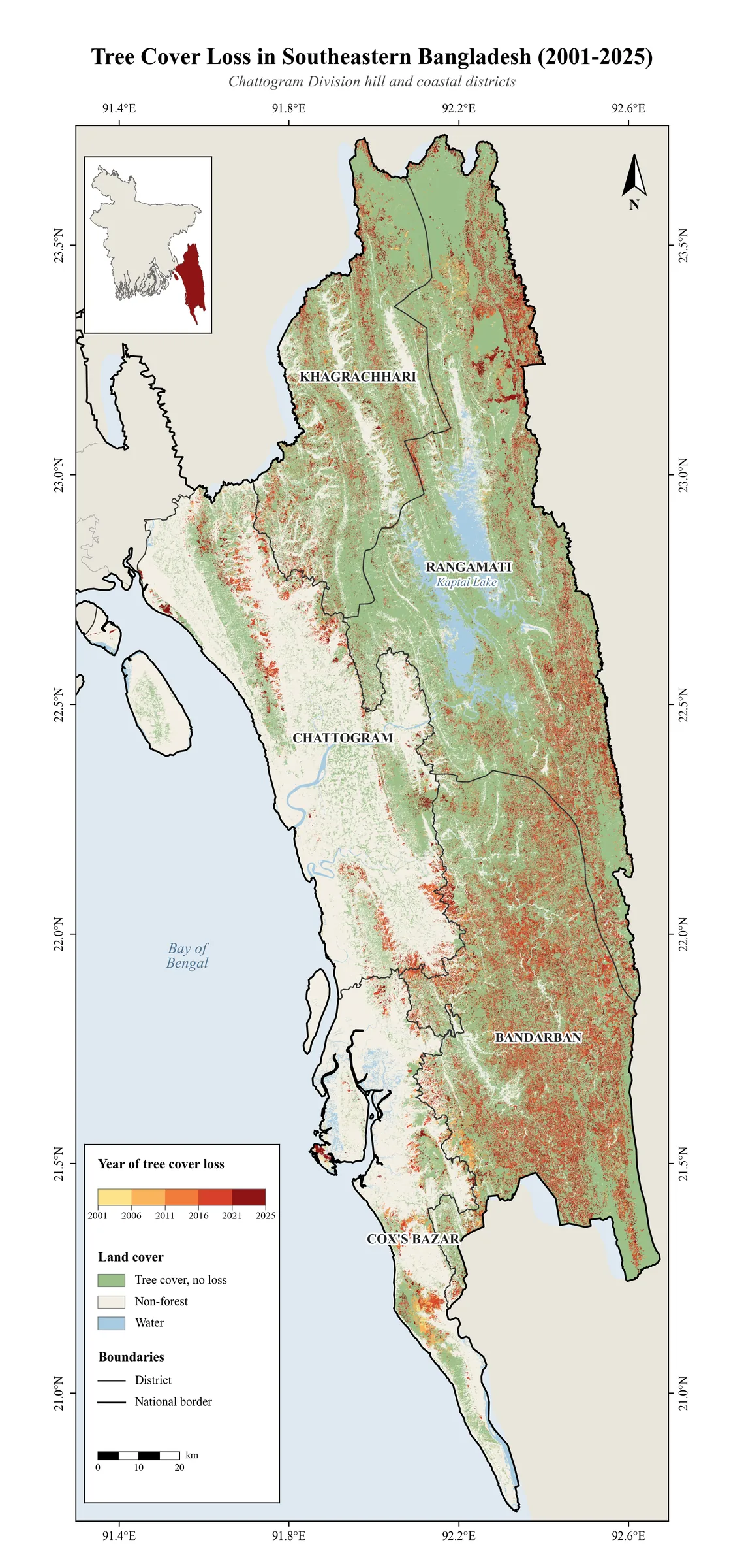
Data: University of Maryland, Hansen Global Forest Change v1.13. Method: Annual loss year classification (30…
The void in the Sundarbans
True-colour satellite view of the Sundarbans mangrove forest, where tidal channels carry sediment into the Bay of Bengal.
The void in the Sundarbans2026
Map by Md Sabbir Islam
About this map
- Made by
- Md Sabbir Islam
- Year
- 2026
- Topic
- Land and terrain
- Data
- ESA Copernicus Sentinel-2 (Level-2A) from Microsoft Planetary Computer
Using this map: please credit Md Sabbir Islam and link to this page. For a full-resolution copy or permission to reuse it, email me.
More maps
See all maps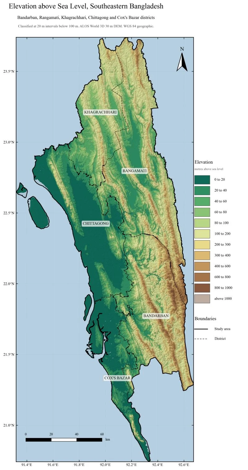
Bandarban, Rangamati, Khagrachhari, Chittagong and Cox's Bazar. ALOS World 3D 30 m DEM.
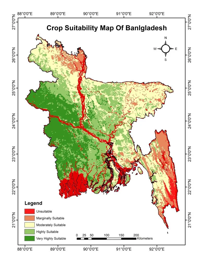
Five suitability classes from BARC data, weighted overlay.
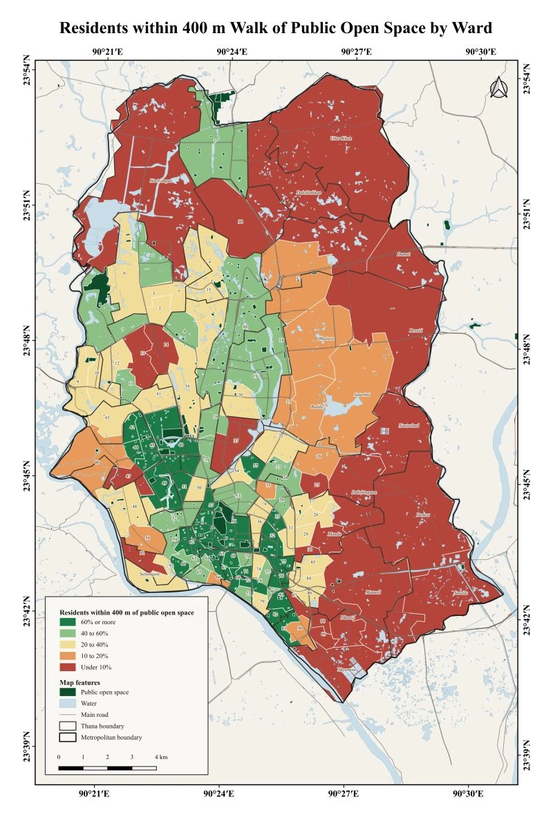
Share of residents in each Dhaka ward who live within a 400 m walk of a public open space. Data…