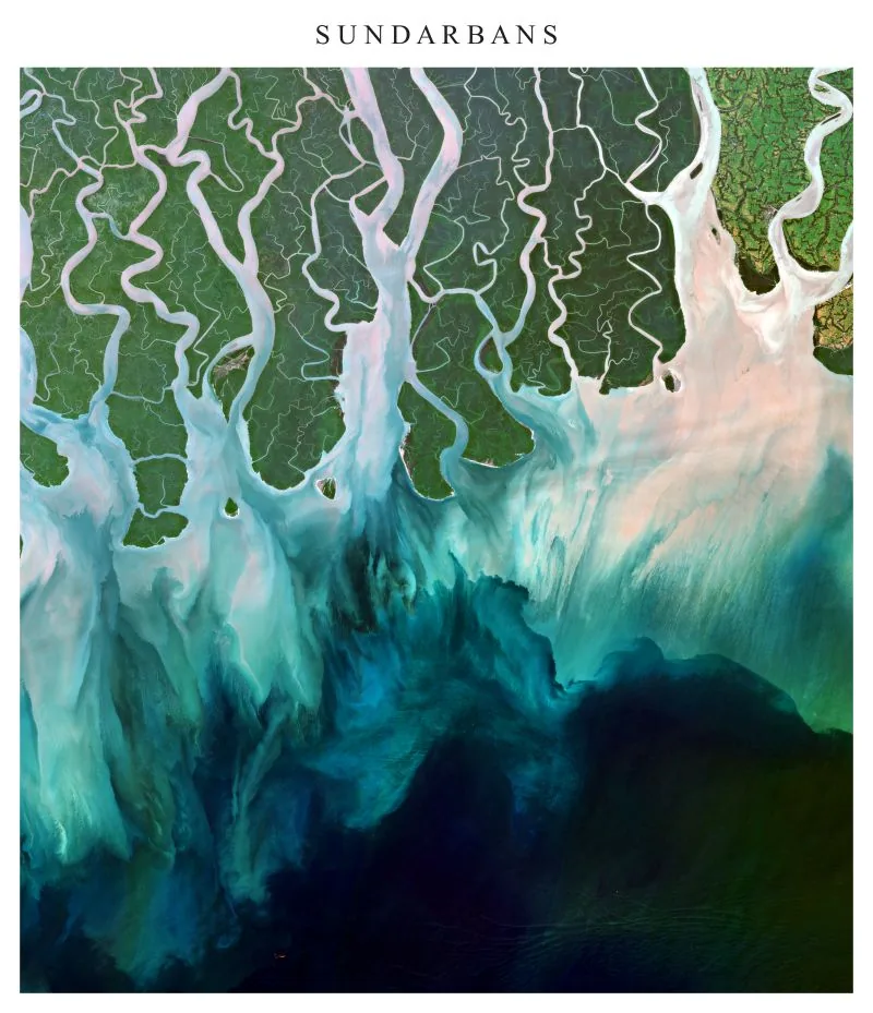
True-colour satellite view of the Sundarbans mangrove forest, where tidal channels carry sediment into the…
Elevation, southeastern Bangladesh
Bandarban, Rangamati, Khagrachhari, Chittagong and Cox's Bazar. ALOS World 3D 30 m DEM.
Elevation, southeastern Bangladesh2026
Map by Md Sabbir Islam
About this map
- Made by
- Md Sabbir Islam
- Year
- 2026
- Topic
- Land and terrain
Using this map: please credit Md Sabbir Islam and link to this page. For a full-resolution copy or permission to reuse it, email me.
More maps
See all maps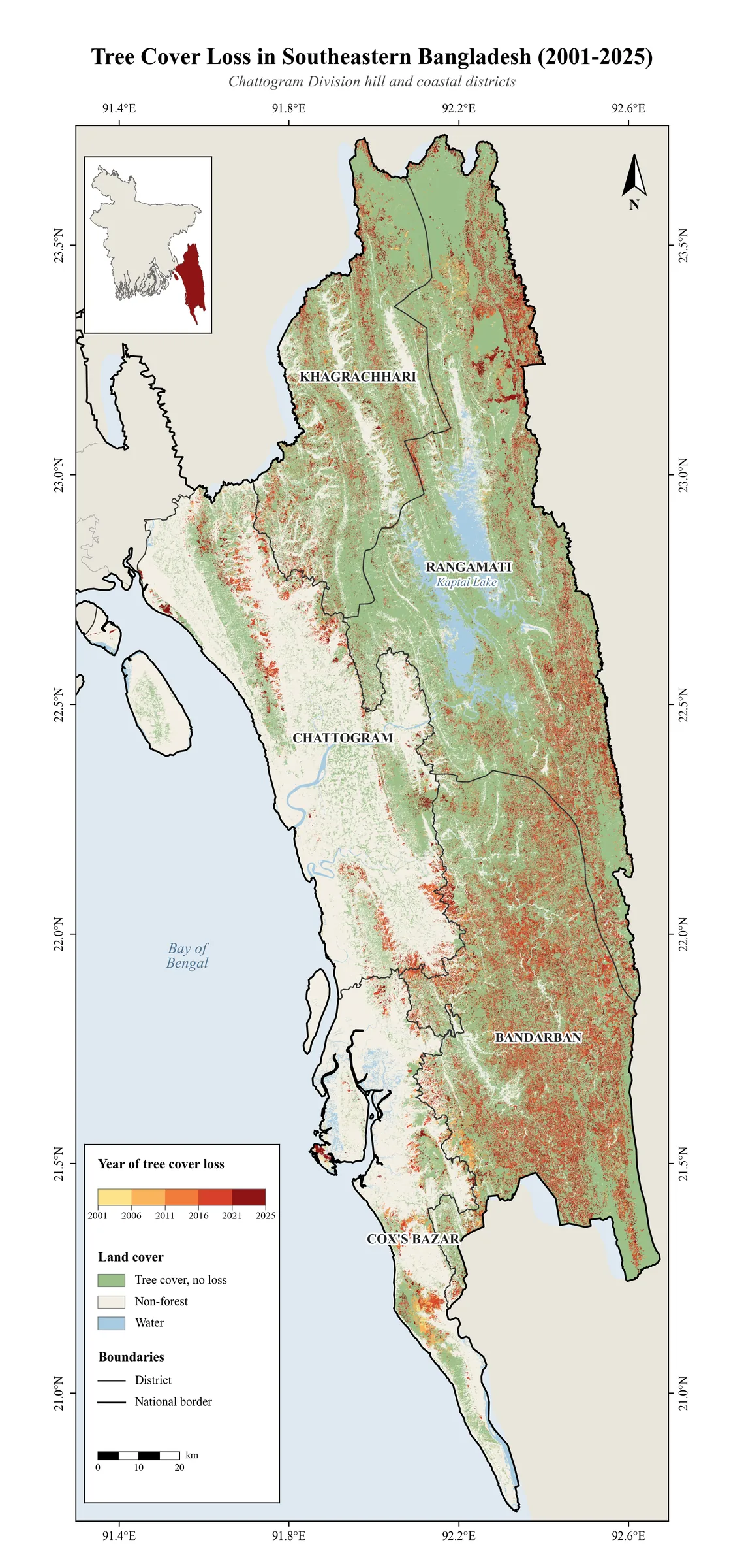
Data: University of Maryland, Hansen Global Forest Change v1.13. Method: Annual loss year classification (30…
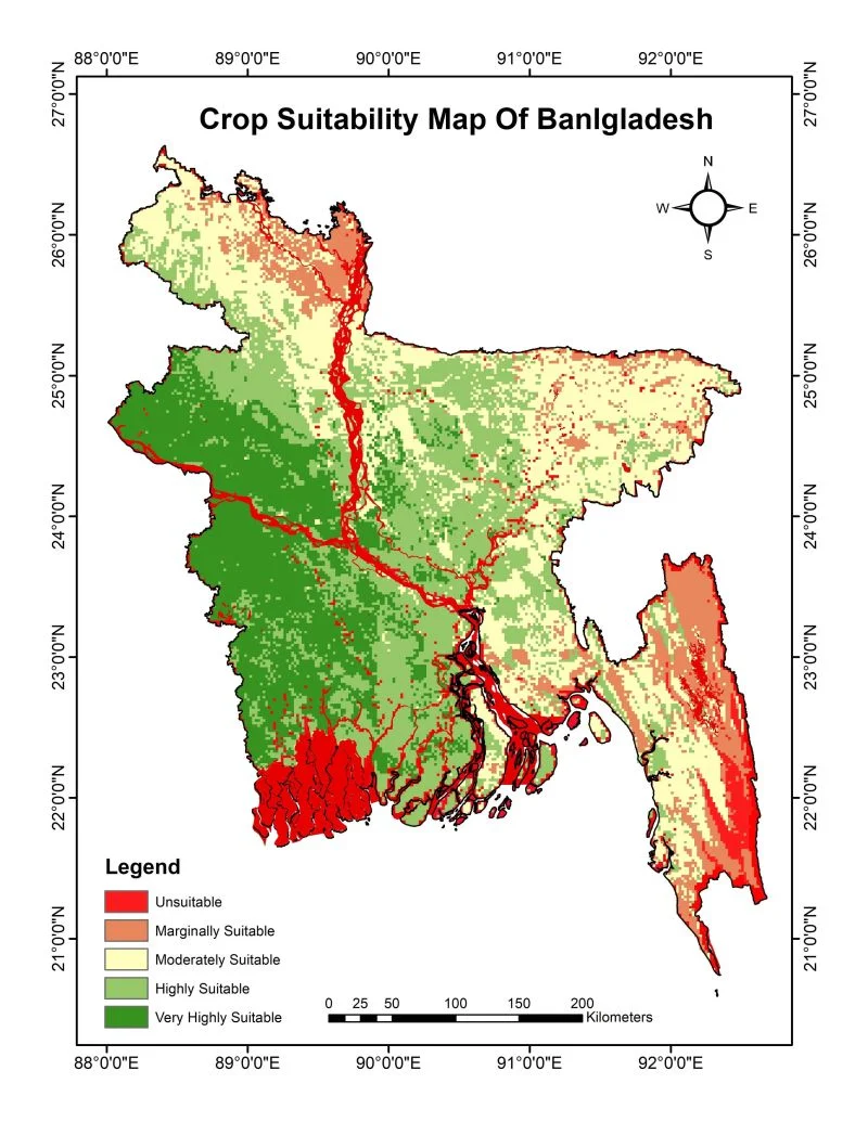
Five suitability classes from BARC data, weighted overlay.
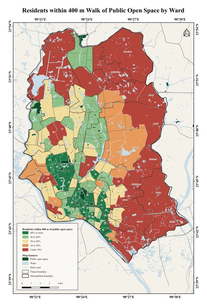
Share of residents in each Dhaka ward who live within a 400 m walk of a public open space. Data…