ORCID LinkedIn GitHub Email
Md Sabbir Islam

Md Sabbir Islam

GIS, Remote Sensing and Geospatial Deep Learning

Remote sensing researcher at PUST, Bangladesh. I map trees, floods and cyclones with drones, satellites and deep learning.

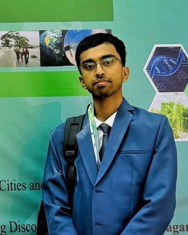
Md Sabbir Islam at the ICLESSD-2025 conference, Jagannath University, Dhaka
Studying
B.Sc. (Honours) Geography and Environment, Pabna University of Science and Technology
Lab
Geospatial Lab of Environment and Disaster
Research focus
Urban planning, Vegetation, Land use change, Hazard and risk, Environmental monitoring
Based in
Pabna, Bangladesh
24.0° N, 89.2° E

Latest maps

See all maps

Walking access to public open space in Dhaka2026

Share of residents in each Dhaka ward who live within a 400 m walk of a public open space. Data: OpenStreetMap, WorldPop 2025. Method: Network-based walking distance. Tools: QGIS.

Kutupalong-Balukhali Refugee Camp2026

Mean density of structures per km² in each camp of the Kutupalong-Balukhali refugee camp complex, Cox's Bazar, Bangladesh. Structures include shelters, latrines, clinics and learning centers, not population. Data: OpenStreetMap. Tools: QGIS.

Maritime Traffic Density in the Bay of Bengal (2015-2021)2015-2021

Data: World Bank & IMF, Global Shipping Traffic Density (AIS). Method: Log-scaled density classification. Tools: Python (rasterio, geopandas, matplotlib).

Recent research

Read all research
  1. 2026Journal manuscriptUnder review

    Characterization of Urban Trees with Deep Learning Techniques in Pabna Municipality

    Submitted to a peer-reviewed journal

  2. 2026Journal manuscriptUnder review

    Spatio-temporal Patterns of Lightning Events and Associated Casualties in Bangladesh: Linkages with Land Use and Land Cover

    Submitted to a peer-reviewed journal

  3. 2026Conference paperPresented

    Impact of Armed Conflict on Ambient Air Quality: A Multi-Pollutant Spatiotemporal Analysis Across Iranian Provinces, 2022 to 2026

    International Conference on Emerging Frontiers in Advanced Sciences and Technologies (EFAST 2026), Pabna, Bangladesh

Code projects

See all projects

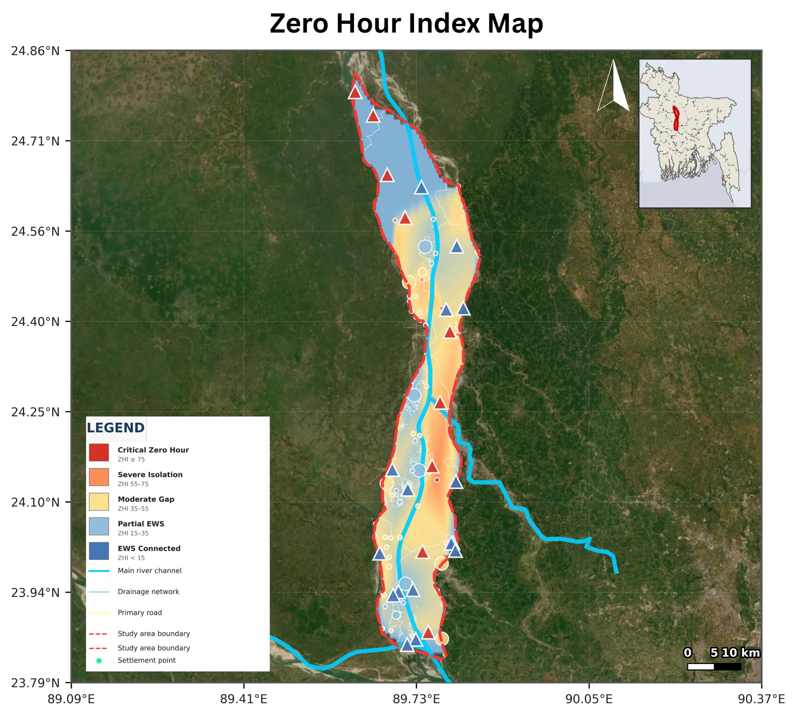
Maps early warning last-mile gaps in the Jamuna-Padma char corridor: where floods, failed roads and submerged mobile towers cut settlements off at the same time. Built for the RIMES Mapathon 2026.

Python, Google Earth Engine, Sentinel-1, QGIS
Code for my thesis: a canopy model trained on UAV imagery labels a city-wide satellite classifier, then crowns are converted to biomass, carbon and ward statistics for Pabna Municipality.

Python, PyTorch, Random Forest, UAV

Education and experience

  1. 2025 to present

    Undergraduate Thesis Researcher

    Geospatial Lab of Environment and Disaster, Pabna University of Science and Technology. Supervised by D. Eng. Md Rahedul Islam, Professor.

  2. 2025

    Field Data Collector, CH4Rice Project

    In collaboration with the JAXA Earth Observation Research Center and the Institute of Industrial Science, University of Tokyo.

  3. 2026

    B.Sc. (Honours) in Geography and Environment

    Pabna University of Science and Technology. CGPA 3.56 / 4.00 across seven semesters; coursework completed, final result awaited.

Skills

Deep learning
PyTorch, SegFormer, U-Net, DeepLabV3+, Mask2Former, YOLO, Mask R-CNN
Remote sensing
Google Earth Engine, SNAP, Rasterio, GDAL, ArcGIS, QGIS
Satellite data
PlanetScope SuperDove, Sentinel-1, Sentinel-2, Landsat, MODIS
UAV
DJI platforms, Agisoft Metashape, Pix4D, point cloud processing
Spatial statistics
Moran's I, Getis-Ord Gi*, kernel density estimation, hotspot analysis
Programming
Python, R, JavaScript for Earth Engine, Git, LaTeX

Research interests

  • Geospatial deep learning
  • Object detection
  • UAV and satellite data fusion
  • Tree crown delineation
  • Above-ground biomass
  • Land use and land cover change
  • Spatial statistics
  • Hazard and risk mapping
  • Environmental monitoring

Awards

  • 2023Top 8 Team, FOREWARN Disaster Hackathon 1.0
  • 2023Runners-up, 6th Interdepartmental Language Debate, Pabna University of Science and Technology

Languages

  • Bengali, native
  • English, professional working proficiency

Contact

Open to research collaboration, mapping work and questions about any project.